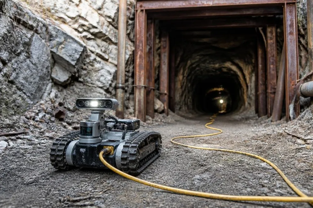
An abandoned mine can hide flooded shafts, loose rock, bad air, and broken structures. A robot could enter first, build a map, and send back sensor readings before a person steps underground.
Quick read
- LiDAR can map tunnels when lights and GPS stop working.
- Gas sensors can check methane, carbon monoxide, and oxygen levels.
- A tethered robot can keep a data link through turns and heavy walls.
Why mines are hard for robots
A mine is a poor place for ordinary autonomous systems. GPS signals do not reach underground, radio links weaken around rock, and a route that looks clear on a map may end at a collapsed passage.
The floor creates another problem. Water, mud, rails, loose stones, and steep slopes can stop wheels. A tracked base may handle more ground types, while a legged robot could step over smaller obstacles. Each choice brings a cost in weight, power use, speed, and recovery if the robot falls.
A robot also needs to know where it is. Simultaneous localization and mapping, or SLAM, combines sensor data with movement to build a map while the robot travels.
LiDAR measures distance with laser pulses, while cameras add visual detail when the air and light permit it. That map would not need to be perfect to help. It could show which tunnel branches remain open, where water blocks the route, and where a later inspection should begin.
Sensors do more than draw a map
A mine robot would need to check the air as it moves. Methane can collect in underground spaces, carbon monoxide can come from fires or engines, and low oxygen can make an area unsafe even when the tunnel looks clear.
The robot could carry gas sensors beside thermal cameras, microphones, and an inertial measurement unit. The inertial unit tracks changes in motion when the robot loses a clear view, while thermal imaging can point to heat from equipment, fire, or a person.
Sensor placement matters. A gas reading near the robot's roof may differ from one close to the floor. A useful survey would record the sensor position with each measurement, then place those readings on the mine map.
This is where the machine's job becomes more than driving into a dark tunnel. It would connect location, air data, images, and sound so an operator can judge what needs attention.
Tethered, remote, or autonomous?
A tether gives the robot a steady path for data and can carry power from the surface. The cable can snag on rails, sharp rock, or corners, though, and a long tether adds drag. A reel must control that cable without pulling the robot off its route.
A wireless robot has more freedom of movement but may lose its link after a turn or behind thick rock. It can store sensor data and return later, but that makes recovery harder if the robot stops in a flooded or damaged section.
Remote control sits between those choices. An operator can react to a blocked route or an odd gas reading, while onboard software handles balance, collision checks, and short movements. Full autonomy could cover more ground, but its safe limits would need testing in the actual mine.
A mine survey needs a record of the robot, sensors, route, gas readings, and human support. Reports in Robot24.com's robotics coverage can show whether an underground test ran long enough to expose blocked routes, weak signals, or unsafe readings. Those details give you a better basis for judging a mine robot before it enters a sealed tunnel.
What a mine survey would need
A first mission should start with a route that can be recovered. The robot needs a clear return plan, a way to mark its position, and a surface team that can respond when the data link drops.
A practical field checklist looks like this:
- Check the mine plan and recent site records before choosing an entry point.
- Fit gas sensors, LiDAR, cameras, and an inertial measurement unit.
- Test the tether, reel, radio link, and emergency stop above ground.
- Set a return rule for low battery, lost communications, rising gas levels, or rising motor temperature.
- Save sensor data with time and position labels so the map can be reviewed later.
- Keep people outside the surveyed area until the readings and structure map support entry.
The checklist deals with a hard limit: a robot can report conditions, but it cannot make an unsafe tunnel safe. Engineers still need to judge roof strength, water pressure, old supports, and the risk of a second collapse.
What happens next
The first useful deployment may be less dramatic than a robot disappearing for hours underground. A small machine could survey a short branch, return with a map, and show whether its sensors stayed reliable through water, dust, and signal loss.
I'd choose a recoverable robot with strong data records before choosing one that promises full autonomy. Until field teams can repeat those surveys in different mines, abandoned workings remain a test of communication and recovery as much as movement.